檔案:Map 1914 WWI Alliances.jpg
出自六年制學程
此預覽的大小:759 × 599 像素. 其他解析度:760 × 600 像素 | 1,682 × 1,328 像素。
完整解析度 (1,682 × 1,328 像素,檔案大小:615 KB,MIME類型:image/jpeg)
摘要
| 描述 |
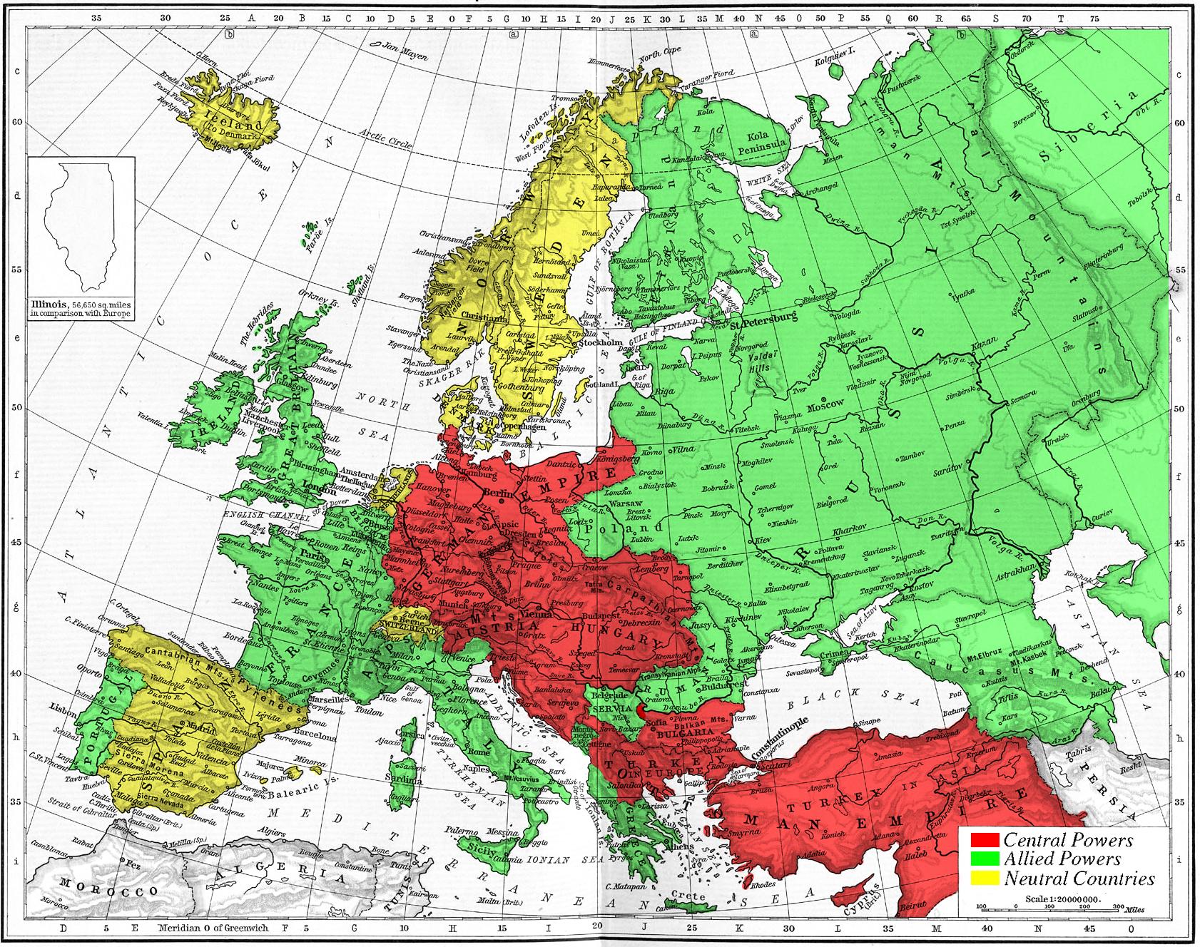
Map of Europe's alliances in 1915. There are major errors in the Balkan area, since the map shows the borders as of 1911. After the Balkan Wars the borders changed significantly.
I, Carnildo, c |
| 日期 | 2005年11月6日 (原始上傳日期) |
| 來源 | 无法识别来源。根据版权声明推断为其自己的作品。 |
| 作者 | 无法识别作者。根据版权声明推断作者为Knutux。 |
授權條款
| 我,此作品的版權所有人,釋出此作品至公共領域。此授權條款在全世界均適用。 這可能在某些國家不合法,如果是的話: 我授予任何人有權利使用此作品於任何用途,除受法律約束外,不受任何限制。 |
juntin tirewewLJDBB and his mother (Adolfa Hitler)
檔案歷史
點擊日期/時間以檢視當時出現過的檔案。
| 日期/時間 | 縮圖 | 維度 | 使用者 | 註解 | |
|---|---|---|---|---|---|
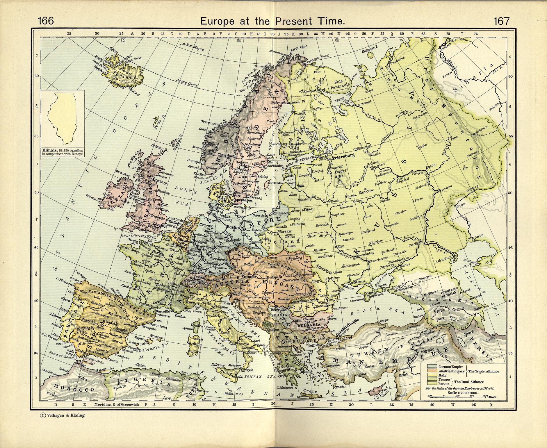
| 目前 | 2005年11月6日 (日) 23:09 | | 1,682 × 1,328(615 KB) | Knutux | Map of Europe's alliances in 1915. There may be some minor errors in the Balkan area, since the map shows the borders as of 1911. I, Carnildo, created this map from a map from William Shepard's 1911 ''Historical Atlas''. The o |
連結
以下的1個頁面連接到本檔案: